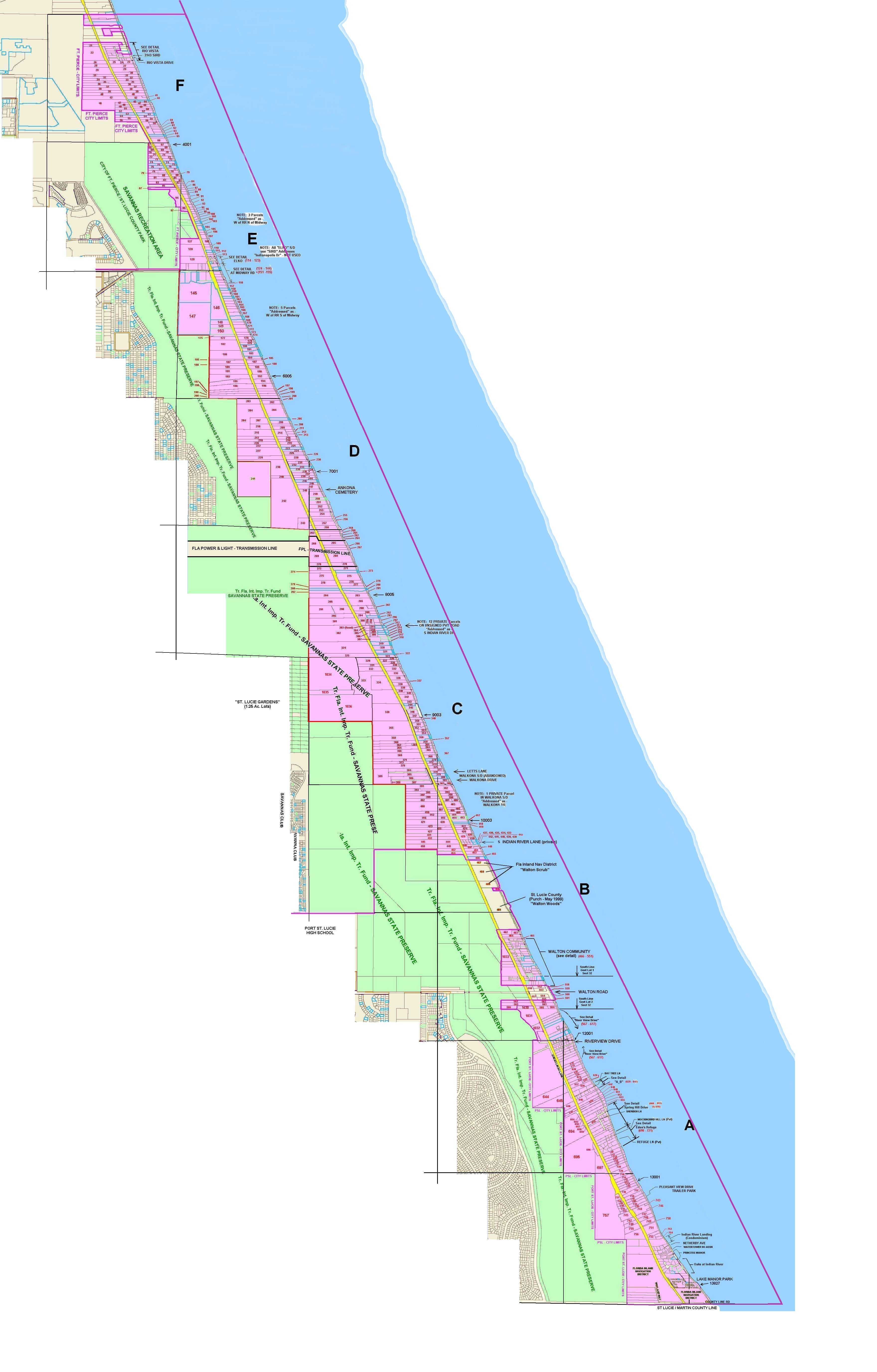
Sector List
Map Sector "E" - 4001 - 6005 South Indian River Drive (Midway Rd. Sector) Parcels (67 - 200)
Map Sector "D" - 6005 - 8005 South Indian River Drive (FP&L Transmission Lines & Ankona Cemetery) Parcels (201 - 284)
Map Sector "C" - 8005 - 10003 South Indian River Drive (Ankona Sector) Parcels (285 - 427)
Map Sector "B" - 10003 - 12001 South Indian River Drive (Walton Sector) Parcels (428 - 566)
Map Sector "A" - 12001 South Indian River Drive to the Martin Co. Line (South Sector) Parcels (567 - 1013)
MAP SOURCE CREDIT:
These maps are "captures" from the online map service provided by the St. Lucie County Florida - Property Appraiser's Office
(The Images were captured on Monday, 03 February 2003)This mapping service also links to an online version of the individual tax parces's property record card as well as aerial photos for the mapped area.
In the map service, you may also turn on / turn off various map "overlays" e.g. parcel boundaries, subdivision boundaries, "dedicated" county properties (roads), zoning boundaries, etc.The preferred Browser for the property appraisers mapping service is MSIE (v5.xx+), and a particular CGM Metafile "plug in" is also required.
(Links to download the required "plug-in" are available)